 Catalogue PIGMA
/Physical Environment/Coastal Hydrodynamics
Type of resources
Available actions
Topics
Keywords
Contact for the resource
Provided by
Formats
Representation types
Update frequencies
status
Scale
Resolution
-
Hydrodynamic and sediment transport simulations in the Gironde Estuary and the adjacent continental shelf based on MARS3D-MUSTANG model using curvilinear mesh grid, 2015 realistic forcing and hourly output time steps
-
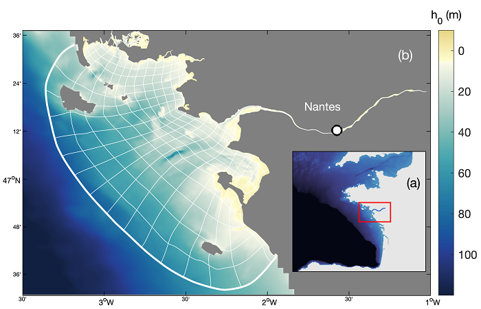
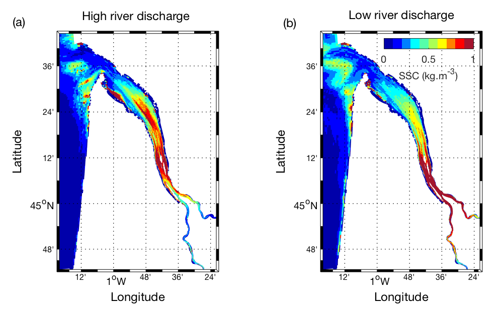
A ten-year numerical hindcast of hydrodynamics, hydrology and sediment dynamics in the Loire Estuary (France), produced by coupling the hydrodynamics model MARS3D with the sediment dynamics module MUSTANG and the wave spectral model WAVEWATCH III®. Numerical simulations are based on the same model chain used in the Seine Estuary (curviseine) and the Gironde Estuary (curvigironde).
-
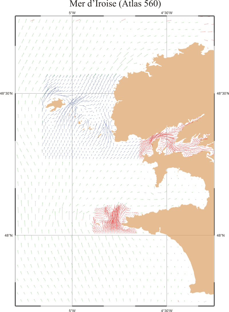
This product contains data in a grid form with all the digital files of the SHOM relating to tides of the Metropolitan French coast in the English Channel and the Atlantic coast. These digital files indicate the components of the tidal surface, hour by hour and for two tidal coefficient characteristics (45 and 95). The current points contained in the files correspond to the arrows shown in the currents atlas.
-
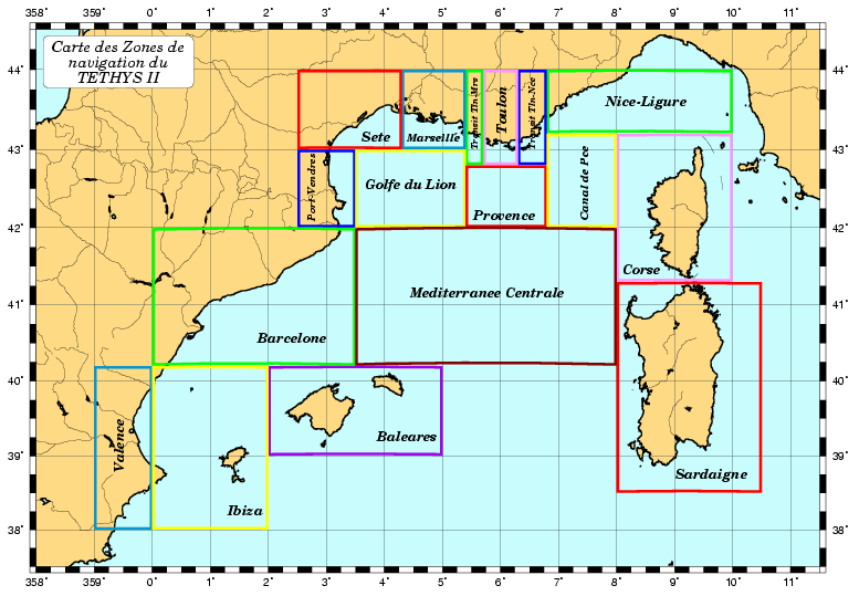
System for Acquiring, Validating and Exploiting Data from INSU Vessels North-Western Mediterranean and Channel/Atlantic French coasts 1996 -
-
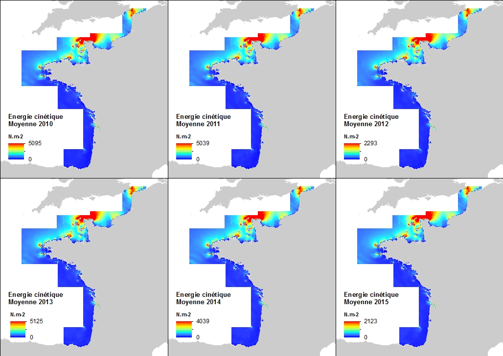
This annual statistics at 500m horizontal resolution was produced from the archived time series of MARS 3D physics model hindcast runs along French Atlantic Coast. The variable that is available here is the Kinetic Energy induced by currents caused by tide, water density gradients and action of winds. The formula used for the Kinetic Energy calculation is 0.5mv², where m is the density of seawater (1027 kg.m-3) and v is the current-induced velocity. Values are expressed in N.m-2 (Newton per square meter). The vertical level is the sea surface.
-
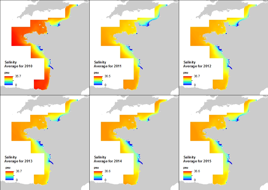
This annual statistics at 500m horizontal resolution was produced from the archived time series of MARS 3D physics model hindcast runs along French Atlantic Coast. The variable that is available here is the Salinity. Values are expressed in psu. The vertical level is the seabed.
-
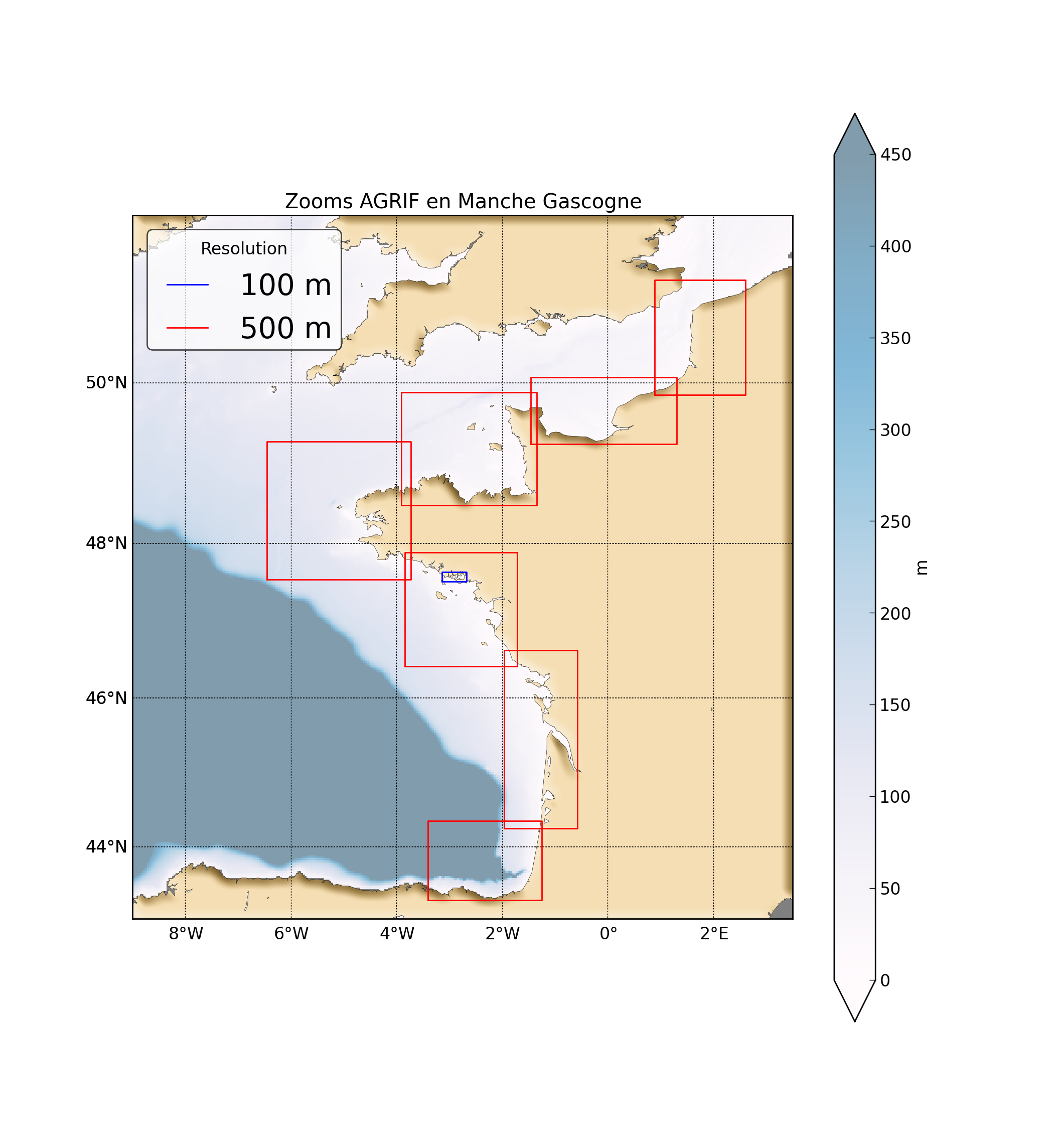
"Abstract: " Hydrodynamic database build with the MARS3D model along the french manche and atlantic coast at high spatial (500m) and temporal (1h) resolution "Details:" Seabed habitats maps are build from statistics models which need some data that describe the physical environment of the different species. Theses environmental factors are the salinity, temperature and shear stress (from waves and current) on the sea floor. Statistics are based on realistic and inter-annual simulations from 3D ocean models.Models output are currently available at a uniform resolution of 2.5 km along the whole French coast,as a part of the PREVIMER project (http://www.previmer.org) To increase the horizontal resolution of the model to 500m grid spacing, an on-line grid refinement technique has been carried out with the AGRIF library. (http://www-ljk.imag.fr/MOISE/AGRIF/) Seven zooms (with 500m resolution) have been implemented in the 2.5 km MANGAE configuration. From this configuration, an hindcast of six years (from 2010 to 2015) has been simulated and cover the french coast from spain to pas-de-calais area : "Main features of the hindcast" Horizontal resolution : 500m Vertical resolution : 40 sigma levels Temporal resolution : 1 Hour "Available physical parameters" ◦ 2D : Sea surface height and barotropic velocities (U and V components) ◦ 3D : Temperature, Salinity and baroclinic velocities
-

This annual statistics at 500m horizontal resolution was produced from the archived time series of MARS 3D physics model hindcast runs along French Atlantic Coast. The variable that is available here is the Salinity. Values are expressed in psu. The vertical level is the sea surface.
-
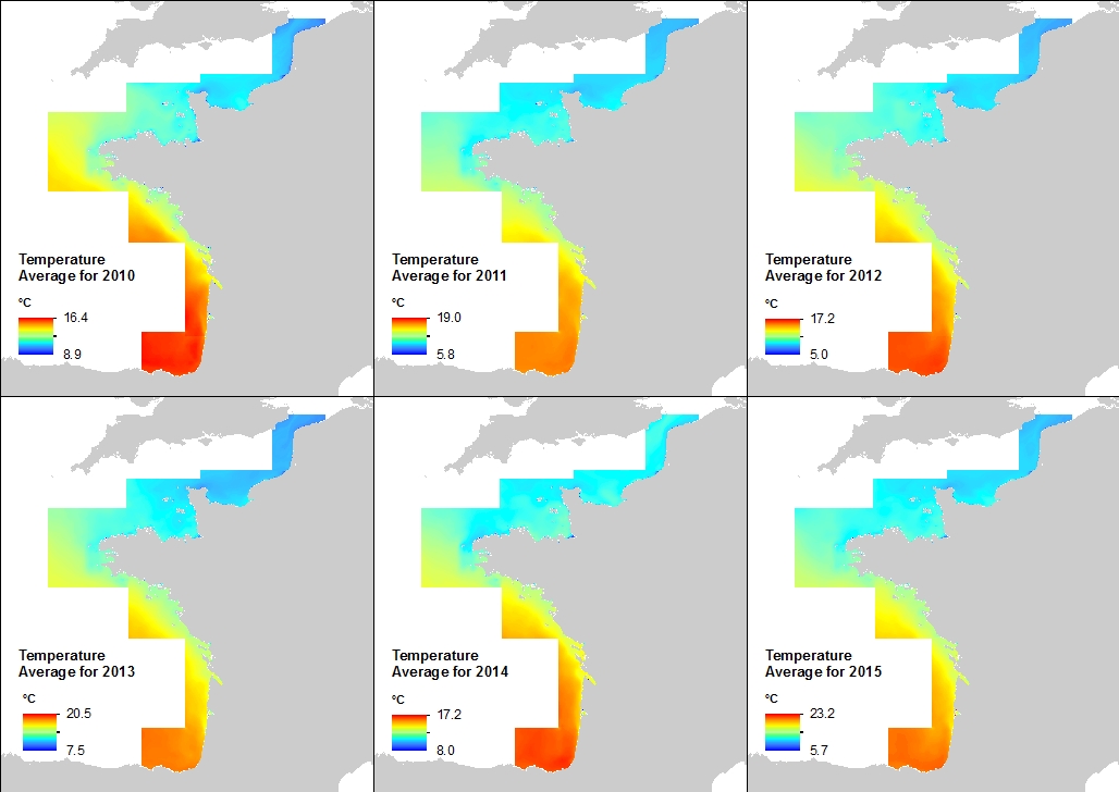
This annual statistics at 500m horizontal resolution was produced from the archived time series of MARS 3D physics model hindcast runs along French Atlantic Coast. The variable that is available here is the Temperature. Values are expressed in Celsius Degrees. The vertical level is the sea surface.
-
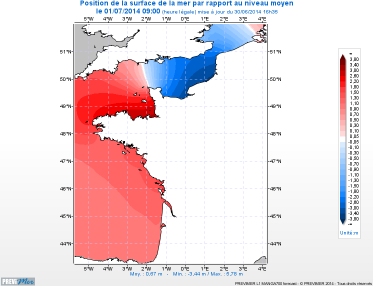
The hydrodynamic MARS 2D model on the Channel / Bay of Biscay coasts is a 2D model of 700m spatial resolution providing currents, sea levels, and maximum/minimum tide levels every hour (4-day forecasts).